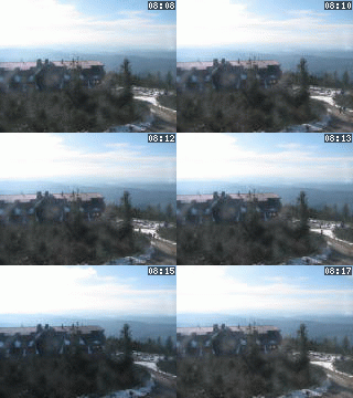
Lysá hora 1323 m n. m. - královna Moravskoslezských Beskyd
Thursday 18. December 2025
Řeka [ Village or Town/City ]

Řeka village originated with an outbreak of fire in the surrounding villages of Smilovice and Guty. The first written reference to it dates from 1644. Řeka is a typical mountain village breaking into the valley of local Beskydy among Gutský, Ropice, Ropička hills and mainly Godula hill from which a famous green sandstone is quarried.
The village is so deeply set in Moravian-Silesian Beskydy it is said that at Řeka you can look only into the sky. The average altitude of Řeka is 420m, the highest point - Ropice hill - is 1,082m high.
The Řeka river flows through the village continuing into the Ropičanka river that discharges into the Olše river. The cadastre of Řeka extents to 1,348 hectares altogether and the whole village formed a part of the Beskydy Protected Landscape Area since 1973. The village has very favourable countryside and climatic conditions for recreation both in summer and winter seasons. It forms a distinctive centre of the tourist industry.
Plní funkci základního stupně územní samosprávy a v různé míře je také vykonavatelem státní správy.
PŮSOBÍ NA KATASTRÁLNÍM ÚZEMÍ:NEXT LINKS
- [ Cycle route ] Cyklotrasa č. 6150 Smilovice - Guty 2.50 km
- [ Cycle route ] Jablunkov Region and Beskydy foothills 29.50 km
- [ Mountains ] Beskydy
- [ Protected Landscape Area ] Protected Landscape Area Beskydy [osm]
LOCATION
- WGS-84: 49.6409973N, 18.5712416E
- Altitude: 420.00 m
- Statistický kód obce: ZUJ 552640
- District of Administration 2: Studénka
- District of Administration 3: Třinec
- Region NUTS 4: Okres Frýdek-Místek
- Region NUTS 3: Moravskoslezský kraj
- Region NUTS 2: Moravsko-Slezsko
- Tourist region: 38 Beskydy - Valašsko
- Destination: Severní Morava a Slezsko
THERE ARE ABOUT VILLAGE OR TOWN/CITY
- Accommodation (2)
- Boarding house (3)
- Cadastral territory (1) [osm]
- Cemetery (1) [gps]
- Church or cathedral (1)
- Country architecture (1)
- Downhill run with ski-tow (1)
- History (1)
- Hotel or hostel (1) [gps]
- Local Authority (1) [gps]
- Map (1)
- Mountaineering (1) [gps]
- Natural point of interest (1)
- Nursery school (1)
- Restaurant (2)
- Sight (1)
- Signboard (1)
- Street or locality (1)
- Swimming pool (2)
- Transportation (3)
INFORMATION: http://obecreka.cz
Type: Village or Town/City
LAST MODIFY: Šormová Helena (INFOSYSTEM s.r.o.) org. 56, 15.11.2021 v 18:56 hodin


