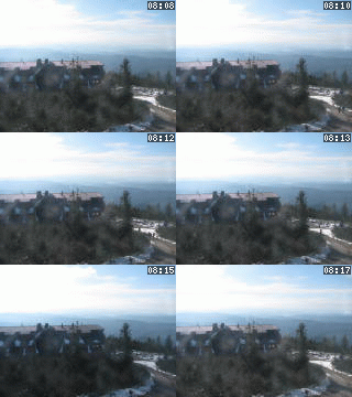
Lysá hora 1323 m n. m. - královna Moravskoslezských Beskyd
Thursday 6. November 2025
Horní Bečva [ Village or Town/City ]

The municipality of Horní Bečva is located in the valley of the upper Becva River in Beskydy Region Preservation Authority (CHKO Beskydy). Becva River separates Vsetínské Hill Range from Moravian-Silesian Beskydy Range.
It is a typical mountain village with the elevation 505 m above sea level in the centre.
Because of its geographical position Horní Bečva is a suitable place for summer and winter holidays.
Visitors to Horní Bečva can find accommodations in a number of different hotels, pensions, private cottages and other accommodation facilities. A number of marked trails for hiking or mountain biking attract visitors to discover the beauty of surrounding mountains during the whole year.
In summer the local dam (area of 5 ha) offers facilities for various sport activities including outdoor swimming and fishing. In winter the ridge trails around Horní Bečva attracts many cross country skiers and down-hill skiers can choose one of 11 ski lifts from 7 different ski resorts.
CONTACT ADDRESS:
Horní Bečva 550
756 57 Horní Bečva
Czechia (CZ)tel: (+420) 571 645 105
fax: (+420) 571 645 248
e-mail: podatelna@hornibecva.cz
Plní funkci základního stupně územní samosprávy a v různé míře je také vykonavatelem státní správy.
PŮSOBÍ NA KATASTRÁLNÍM ÚZEMÍ:- Horní Bečva, Horní Bečva [osm]

NEXT LINKS
- [ Agency of Tourist Industry ] BESKYDY-VALAŠSKO, regionální agentura CR [gps], 283.00 m.n.m.
- [ Cycle route ] Cyklotrasa č. 6015 Benešky-Benešky, Okolo Horní Bečvy 11.50 km
- [ Cycle route ] Cyklotrasa č. 6015 Benešky-Benešky, Okolo Horní Bečvy 3.00 km
- [ Microregion ] Mikroregion ROŽNOVSKO
- [ Mountains ] Beskydy
- [ Protected Landscape Area ] Protected Landscape Area Beskydy [osm]
- [ Tourist path KČT ] Pěší trasa z Horní Bečvy na Pustevny
- [ Water course ] The river Rožnovská Bečva 29.00 km
IN DETAIL
- Blinkova chalupa z Horní Bečvy, Valašské muzeum v přírodě [ Country architecture ]
LOCATION
- WGS-84: 49.423888889N, 18.304722222E
- Altitude: 505.00 m
- Statistický kód obce: ZUJ 542687
- District of Administration 2: Rožnov pod Radhoštěm
- District of Administration 3: Rožnov pod Radhoštěm
- Region NUTS 4: Okres Vsetín
- Region NUTS 3: Zlínský kraj
- Region NUTS 2: Střední Morava
- Tourist region: 38 Beskydy - Valašsko
- Destination: Severní Morava a Slezsko
THERE ARE ABOUT VILLAGE OR TOWN/CITY
- Horské sedlo (2)
- Turistická známka (1)
- Potravinářský podnik (4)
- Vila (1) [gps]
- Vodní plocha (1) [gps] [osm]
- Ambulance (4)
- Association (1)
- Boarding house (8)
- Bowling or skittles (1)
- Cadastral territory (1) [osm]
- Car-camping (1) [gps]
- Cash dispenser (1) [gps]
- Church or cathedral (1) [gps]
- City or Community Services (1) [gps]
- Committee (1)
- Cottage, chalet (19)
- Cycle route (1)
- Dentistry (1)
- Downhill run with ski-tow (7)
- Drycleaner (1)
- Emblem and flag (1)
- Encyclopedic headword (1)
- Fast food (1) [gps]
- Fire department (1) [gps]
- Gas station (1) [gps]
- History (1)
- Hotel or hostel (9)
- Lending Office (2)
- Library (1) [gps]
- Local Authority (1) [gps]
- Local Board of Representatives (1)
- Map (1)
- Monument or Memorial (1)
- Natural Monument (3)
- Natural point of interest (1)
- Notable personality (1)
- Official Board (1)
- Parish church or parish office (1)
- Parking place (1) [gps]
- Pharmacy (1) [gps]
- Police (1)
- Post Office (1) [gps]
- Primary school (1) [gps]
- Private Accommodation (6)
- Pub (1)
- Recreational area (5)
- Restaurant (2)
- Services (19)
- Shop (1) [gps]
- Signboard (2)
- Significant native (3)
- Ski Area (3)
- Special School Institution (1) [gps]
- Sports-club (4)
- Street or locality (3)
- Taxi (1)
- Tourist path KČT (1)
- Town council (1)
- Town vice-mayor (1)
- Transportation (3)
- Weather station (1) [gps]
- WEB Camera On-Line (2)
- Worker (1)
INFORMATION: http://www.hornibecva.cz
Type: Village or Town/City
LAST MODIFY: Šormová Helena (INFOSYSTEM s.r.o.) org. 150, 05.11.2021 v 21:02 hodin


