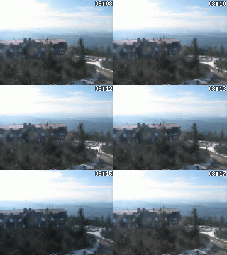
Lysá hora 1323 m n. m. - královna Moravskoslezských Beskyd
Saturday 24. May 2025
Castles and historical towns [ Cycle route ]


Details on route C1 - click on village / For crossing on next routes - click on C2 or B
Castles and historical towns
Příbor, Kopřivnice, Štramberk, Rybí, Nový Jičín, Starý Jičín, Starojická Lhota, Palačov, Poruba, Hustopeče nad Bečvou, Němetice, Zámrsky, Skalička, Ústí, Teplice nad Bečvou, Týn nad Bečvou
Previous stages:
A1 (Jablunkov Region and Beskydy foothills) nebo A2 (Těšín region), B (From Beskydy to Hukvaldy)
Further linked stages:
D (Moravian Gate)
The route goes through a slightly hilly country. It offers many cultural and natural tourist attractions (museums, a tower, a castle, expositions, caves etc.) and a variety of possibilities to eat well and to find a good accommodation.
High profile of the route
PHOTO ALBUM
COURSE OF CYCLE ROUTE
- 0.00 km Hukvaldy [ Village or Town/City ] [gps] [osm], 282.00 m.n.m.
- 11.40 km Příbor [ Village or Town/City ] [gps] [osm], 278.00 m.n.m.
- 14.20 km Kopřivnice [ Village or Town/City ] [gps] [osm], 320.00 m.n.m.
- 17.30 km Štramberk [ Village or Town/City ] [gps] [osm], 415.00 m.n.m.
- 20.60 km Rybí [ Village or Town/City ] [gps] [osm], 326.00 m.n.m.
- 26.00 km Nový Jičín [ Village or Town/City ] [gps] [osm], 285.00 m.n.m.
- 32.40 km Starý Jičín [ Village or Town/City ] [gps] [osm], 295.00 m.n.m.
- 35.60 km Starojická Lhota [ Cadastral territory ] [gps] [osm], 328.00 m.n.m.
- 39.00 km Palačov [ Cadastral territory ] [gps] [osm], 343.00 m.n.m.
- 41.50 km Poruba nad Bečvou [ Cadastral territory ] [gps] [osm]
- 43.65 km Hustopeče nad Bečvou [ Village or Town/City ] [gps] [osm], 272.00 m.n.m.
- 48.40 km Němetice [ Cadastral territory ] [gps] [osm], 367.00 m.n.m.
- 49.15 km Zámrsky [ Village or Town/City ] [gps] [osm], 340.00 m.n.m.
- 53.00 km Skalička [ Village or Town/City ] [gps] [osm], 268.00 m.n.m.
- 55.10 km Ústí [ Village or Town/City ] [gps] [osm], 257.00 m.n.m.
- 57.70 km Teplice nad Bečvou [ Village or Town/City ] [osm], 333.00 m.n.m.
- 71.00 km Týn nad Bečvou [ Village or Town/City ] [osm], 238.00 m.n.m.
LOCATION
- Village or Town/City: Hukvaldy
- District of Administration 2: Frýdek-Místek
- District of Administration 3: Frýdek-Místek
- Region NUTS 4: Okres Frýdek-Místek
- Region NUTS 3: Moravskoslezský kraj
- Region NUTS 2: Moravsko-Slezsko
- Tourist region: 38 Beskydy - Valašsko
- Destination: Severní Morava a Slezsko
INFORMATION: http://kmw.greenways.info
Type: Cycle route
LAST MODIFY: Šormová Helena (INFOSYSTEM s.r.o.) org. 2, 16.10.2021 v 15:00 hodin


